Wi-Fi Hotspots in Manhattan Census Tracts (2016)
Project by: Lance Mikhail Punay
Class: Geographic Information Systems
Supervised by: Leah Meisterlin & Dan Froelich
Year: 2022
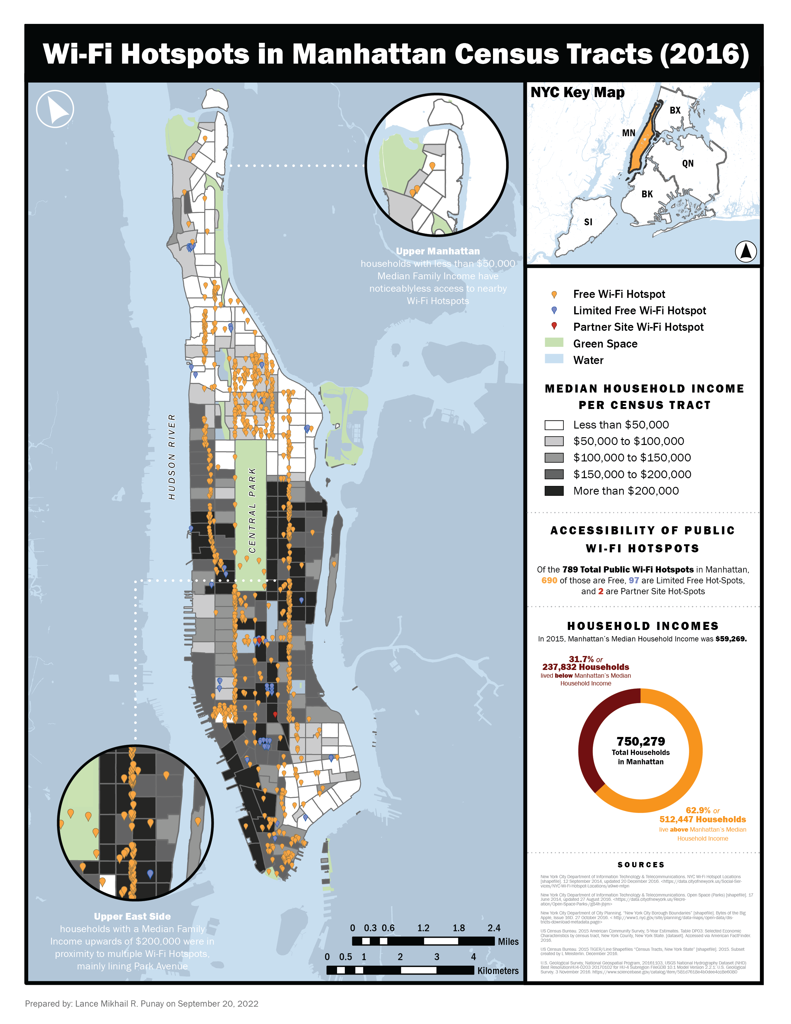
The map produced aimed to investigate potential relationships between the locations of LinkNYC kiosks, which serve as free public Wi-Fi hotspots, and Median Household Incomes in Manhattan.
Using ArcGIS Pro, points representing the LinkNYC kiosks were overlaid against the Median Household Income per census tract in the borough with areas displaying noticeable trends called out as well.
Are lower-income neighborhoods in Manhattan comparably served by public Wi-Fi hotspots as higher-income neighborhoods?