Mapping Housing Insecurity in New York City (2019)
Project by: Alyana Acacio, Emily Padilla-Chicas, & Lance Mikhail Punay
Report Layout by: Alyana Acacio
Class: Geographic Information Systems
Faculty: Leah Meisterlin & Dan Froelich
Year: 2022
Housing insecurity encompasses various problems like affordability, safety, and housing loss.
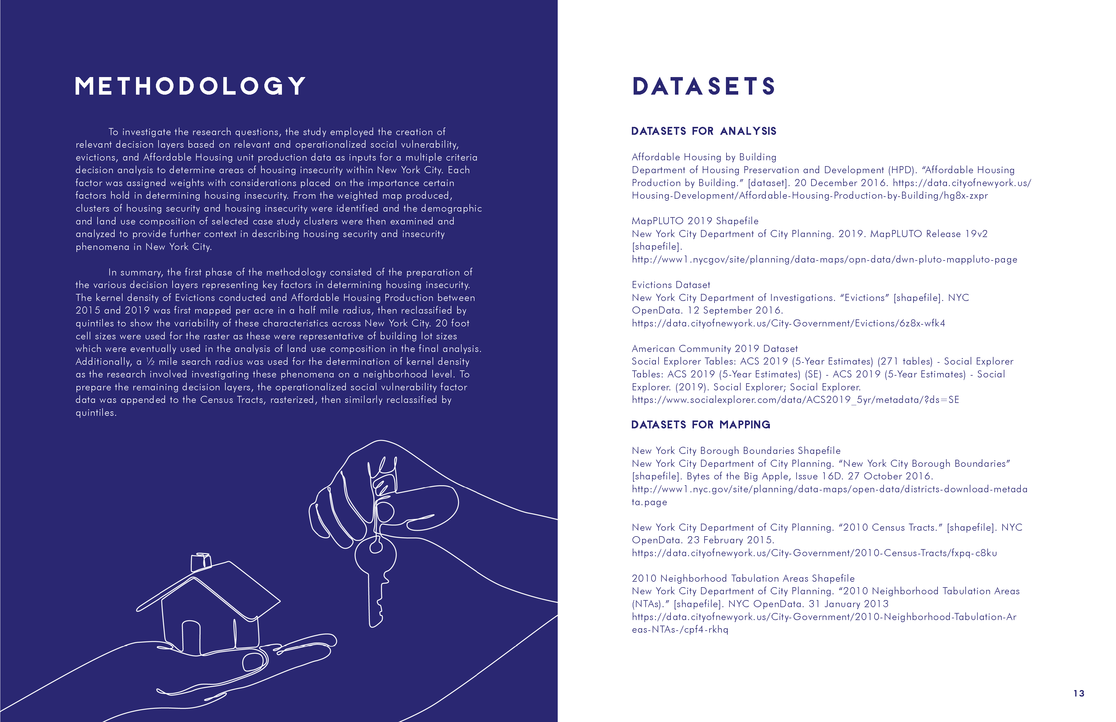
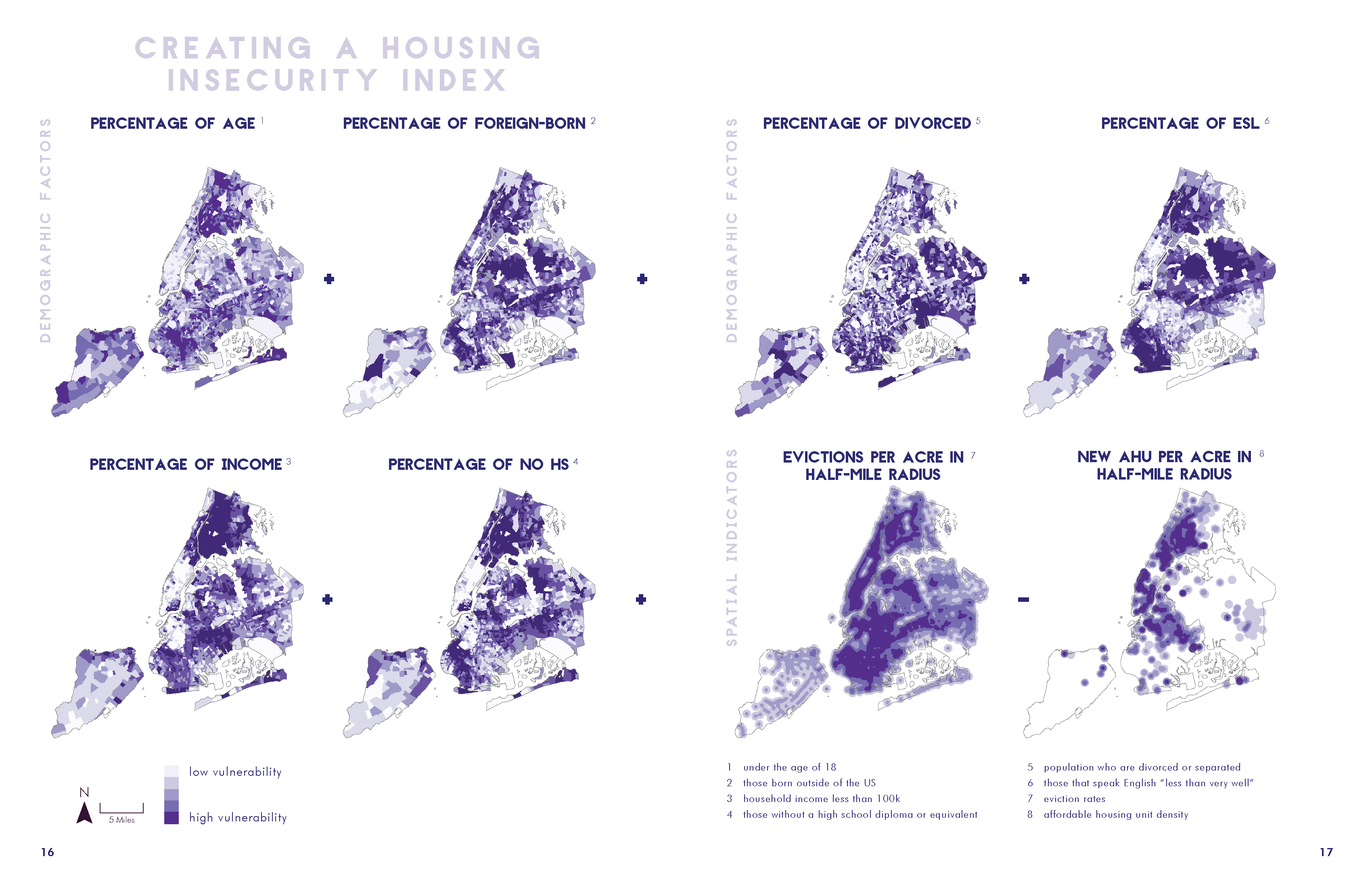
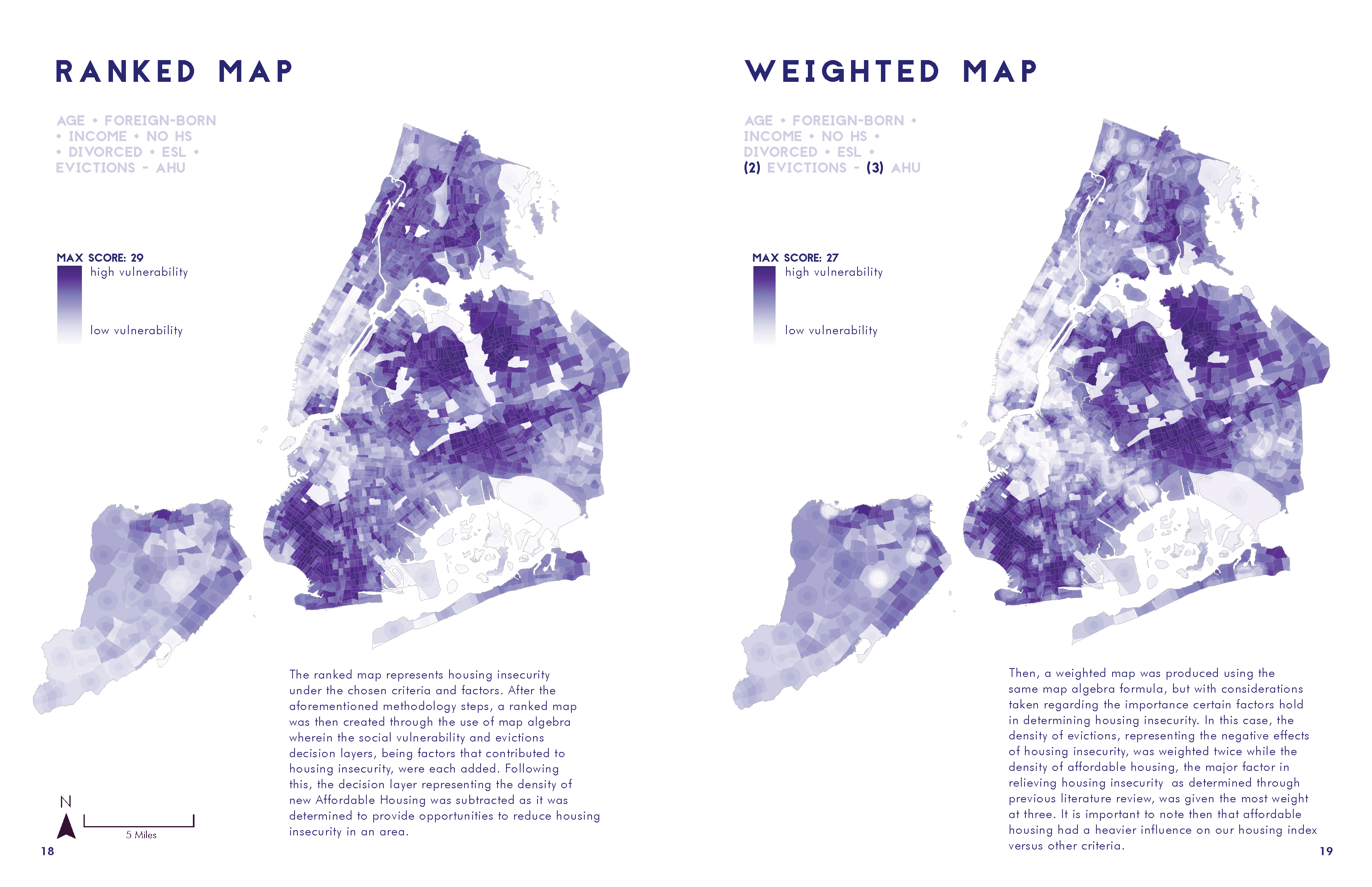
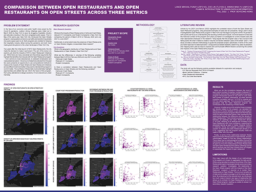
This study aimed to identify areas of high and low housing insecurity within New York City operationalized by compounding the impact of relevant socioeconomic and housing variables. A Multiple Criteria Decision Analysis was employed through the creation of weighted decision layers using social vulnerability, eviction, and affordable housing data in ArcGIS Pro. From the weighted map produced, clusters of housing security and housing insecurity were identified, and demographic and land use composition of case study clusters were then analyzed in detail. The study found that areas with low affordable housing density experienced the most housing insecurity.
What are the demographic and land use characteristics and areas of high and low housing insecurity in NYC?