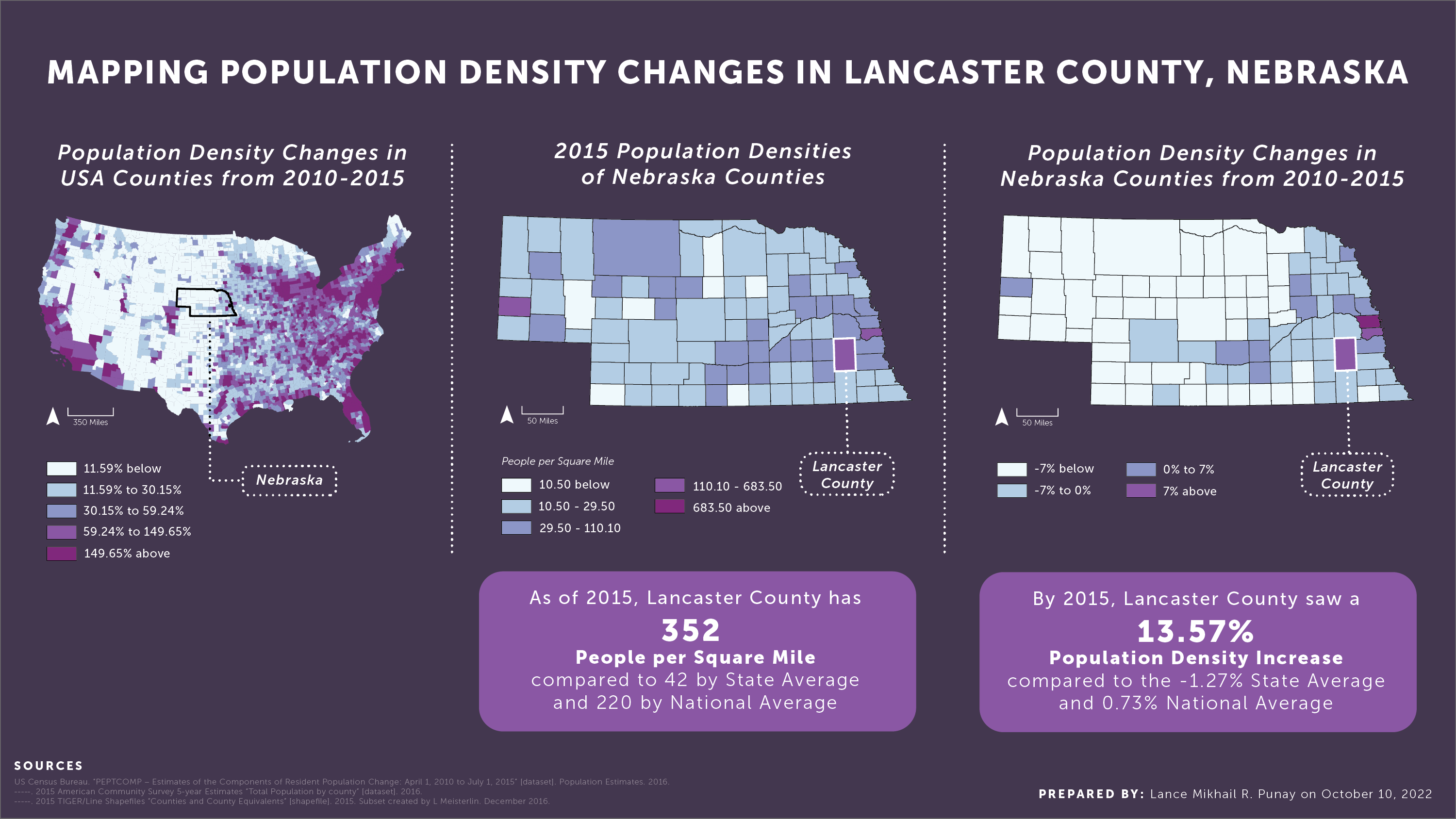
Mapping Population Density Changes in Lancaster County, Nebraska
Project by: Lance Mikhail Punay
Class: Geographic Information Systems
Faculty: Leah Meisterlin & Dan Froelich
Year: 2022
Using population data from the 5-year American Community Survey, the population and population density changes of Lancaster County, Nebraska were mapped and analyzed in relation to both state and national trends from 2010 through 2015. The maps and key findings were then organized and designed as a presentation slide.
What were the trends in population change and population density change in Lancaster County, Nebraska, from 2010 through 2015?
No items found.