Street Tree Density around McCarren Park (2015)
Project by: Lance Mikhail Punay
Class: Geographic Information Systems
Faculty: Leah Meisterlin & Dan Froelich
Year: 2022
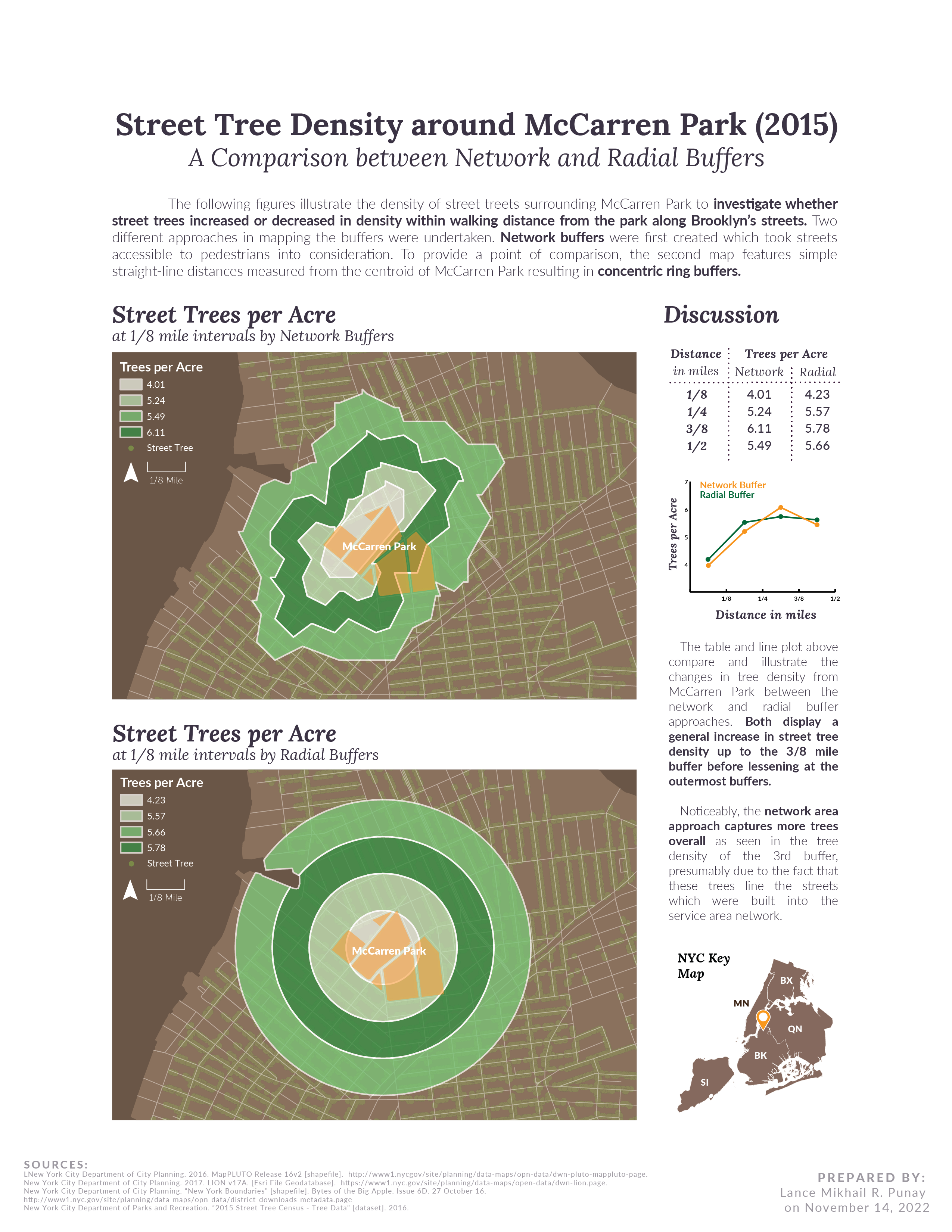
To investigate whether street tree density increases or decreases with walking distance from McCarren Park along Brooklyn’s streets, two different approaches in mapping the buffers were undertaken.
Network buffers were first created which took streets accessible to pedestrians into consideration. To provide a point of comparison, the second map features simple straight-line distances measured from the centroid of McCarren Park resulting in concentric ring buffers.
Do street trees increase or decrease in density with walking distance from McCarren Park, along Brooklyn’s streets?