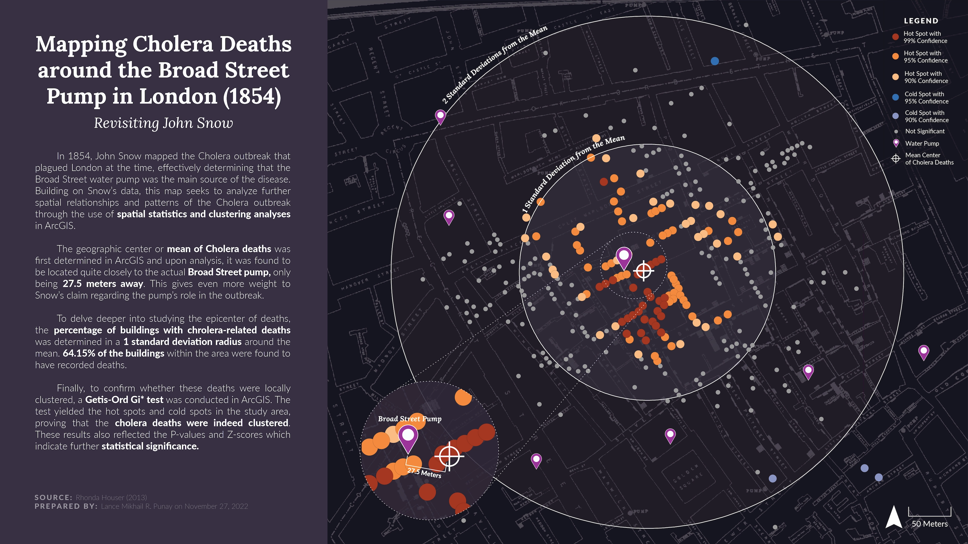
Mapping Cholera Deaths around the Broad Street Pump (1854)
Project by: Lance Mikhail Punay
Class: Geographic Information Systems
Faculty: Leah Meisterlin & Dan Froelich
Year: 2022
In 1854, John Snow mapped the Cholera outbreak that plagued London at the time, effectively determining that the Broad Street water pump was the main source of the disease.
Building on Snow’s data, this map seeks to analyze further spatial relationships and patterns of the Cholera outbreak through the use of spatial statistics and clustering analysis in ArcGIS. Specifically, a Getis-Ord Gi* Test was conducted, which yielded the hot spots and cold spots in the study area, proving that the cholera deaths were indeed clustered.
Were cholera-related deaths statistically “clustered” around the Broad Street water pump or were they spread across the neighborhood (either evenly or randomly)?